Sunday, July 20, 2014

Lake On The Cloud

As this is the largest of Michigan’s state parks, we drove 25 miles from our campsite to the other end of the park and the visitor’s center.  About 7 miles back along Lake Superior’s coast we drove to the view point for Lake on the Cloud on the east side of a large rocky escarpment, nestled in a valley filled with trees.  It was a pretty lake.

P1010176

We then drove about half way back to the RV and stopped to hike the Summit Trail Loop which took us on Beaver Creek Trail, Carp River Trail, Mirror Lake Trail and then back to the Summit Trail. It was a very pretty and peaceful hike.  We saw lots of chipmunks, a covey of brown grouse and toads.  Unfortunately for one toad, a snake also spotted it and ate it!  We almost stepped on the snake as it was trying to move the toad off the trail. 

P1010178

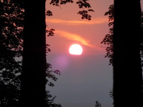
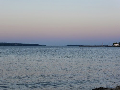
We have a nice view of the sun setting into Lake Superior each evening and tonights sunset was pretty spectacular!

P1010180

I have had enough of the buzzing mosquitoes and biting flies so spent the evening inside the RV.  I can only take so much of these annoying pests!!!

Saturday, July 19, 2014

Porcupine Mountain Wilderness

We drove all the way across the U.P. to Irontown and then north up the coast of Lake Superior to this state park which claims to have the highest mountain in Michigan.  We picked our site, parked the RV but when we got out the black flies swarmed all over the RV and all over US! They were horrible!  I visited with the park ranger and they said that we were probably too close to the lake and if we camped further back it might be better.  We could also hope for wind and the flies usually decreased in number during the evening.  So we moved two rows inland and went for a hike!

P1010169

P1010170

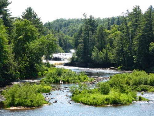
We are parked on the Presque Isle River which empties into Lake Superior.  Our hike took us 1 mile up the river and back on the other side.  We passed three waterfalls.  The names of the waterfalls came from the Ojibwa Indians.  Manabezho Falls is named for the Ojibwa’s god. Manido Falls means ‘ghost’ in Ojibwa and Nawadaha Falls translates into ‘water of the spirit’.  We have read that this park is the largest state park in Michigan and has around 45 waterfalls.

P1010172

P1010173

The flies did go away this evening but the mosquitoes took their place!  At least our OFF candle works! We are back in the central time zone here but just 5 miles north it’s eastern time, confusing. We are staying on eastern time as we have been for weeks.

P1010174

Friday, July 18, 2014

Rally Days

The week has gone by fairly quickly.  I walked every morning for 30-40 minutes with a dedicated group of men and women, John joined us once. We had a large breakfast every morning, a carry-in dinner one night and the closing dinner on Friday evening.

We changed some more of our lights to LED bulbs, got the coach washed, and rode our bikes around the town. On our bike ride we found a meat processor and got some good steaks and pork chops.  John visited with other vendors while I took in the craft show and craft sales one day and a fashion show presented by two local shops on another afternoon.  They had some very cute clothes! Thursday night we were entertained by a Southern gospel/blue grass band from Ohio.  They were pretty good.

One of the vendors at the show does total RV renovations from floors to furniture to walls to exterior painting. For awhile now we have been unhappy with our floor as it scratches very easily and leaves white specks where the paint rubs off.  On Friday we decided that we were going to get a better quality tile floor and while we were at it replace the carpeting. And since the floor will be a different color and I have always wanted under-mounted sinks in this coach, we opted to replace all counter tops with Corian, under-mounted sinks in kitchen and bathroom and an under-mounted stove so that I will have one smooth counter top giving me much more work space in the kitchen.  This vendor, MasterTech RV Services in Elkhart IN, was able to get us on his schedule August 18th which means we have no home on the road for 2-3 weeks so we will be traveling home to Sedalia in August!  John feels like he has gone insane - why would anyone want to be in Missouri in August?! We will leave most of our “stuff” in the RV while it is being renovated and go back in early September to drive our RV home.

Immediately following the closing dinner, we loaded up and left Escanaba, beating the crowded Saturday morning rush.  We only drove for about an hour and stopped in Iron Mountain where we found a nice empty parking lot in which to spend the night.


Tuesday, July 15, 2014

Newmar International Rally

Representatives from all 50 states, all Canadian Provinces and Bermuda marched into the opening ceremonies carrying their state or provincial flags to kick off the 2014 Rally.  It is an impressive way to start off the week.

Monday was reserved for golf and regional tours.  We played golf and had a very fun time, met new people and John’s team tied for 5th place.  Other people at the rally took buses to Pictured Rocks, Marquette and Iron Mountain.  Some of the vendors were set up so we tried to get on their list to get work done or to visit with them about our concerns or to get the RV washed.

Tuesday (today) is the first full day of the Rally with all kinds of seminars and working on RVs. I walked for 30 minutes at 7:15 AM (that seems mighty early!) then we had a huge rally breakfast. We got some sensors replaced on our waste tanks, water tank and LP gas tank. John visited with people about our hitch, replacing floors, lights and shades while I shopped.

Some of the new 2015 Newmar Coaches were on display.  I’m not sure that we could ever enjoy living in the luxuriousness of some of these homes.  One had two TV’s in the living room, 1 in the bedroom and 1 outside, 1 1/2 bathrooms, washer and dryer and dishwasher along with an induction stove top.  They had tile floors, granite countertops, tiled back splash, tiles showers with 1-2 shower heads, king beds, electric shades, mood lighting and mirrors everywhere. Leather seating was standard in all the units.  Our little 30 foot Bay Star pales in comparison.

It sounds like we have done a lot of things but it feels like we haven’t done much.  That’s life in the RV!

Sunday, July 13, 2014

Escanaba - Newmar Rally

We broke all recent records leaving camp before 8AM this morning and arrived in Escanaba, MI for the Newmar Rally by 10:30 AM.  We got a pretty nice site, especially compared to what some other units have.  Other than registering and checking out the many goodies in our registration packet and grocery shopping, it has been a quiet day.

Saturday, July 12, 2014

Beaver Lake and Chapel Lake

We have no pictures to post for two days.  Yes, we did have the camera and no, there was nothing spectacular to photograph.  We did find plenty of mosquitoes and sable flies though.

For two days in a row, now, we have driven 30+ miles westward to find what we hoped would be interesting hikes.  Yesterday we hiked in the woods to Little Beaver Lake, enjoying the quiet serenity of the forest and the beauty of the blue lake.  We were able to enjoy all this because it was windy enough to keep the mosquitoes at bay and the flies on the beach.  We had one incident where I sat down for lunch on top of a mossy hill of ANTS!  Just as I got settled John yells “ Get UP! Get UP!”  I’m going “What? What?!”  The tiny ants were all over me!  Needless to say, we moved on!

On the highway back to camp, we spotted two very large birds on the side of the rode.  Big enough to be Emu’s but not.  They had long necks and legs, gray wings with rust and red spots around their faces.  Since we don’t have any cell service I could not look it up on the internet so today I asked a ranger.  They were Sandhill Cranes!  What beautiful creatures, its too bad we didn’t get a picture and have not seen anymore of them.

Today’s hike was supposed to be to Mosquito Falls along Mosquito River but John took a wrong turn and ended up on Chapel Lake Trail headed to Lake Superior.  It was a flat, forest hike and very boring.  The most excitement we had was watching chipmunks scoot out of our way and spotting a red-headed woodpecker.  As soon as we got within 300-400 yards of the water we started swatting sable flies.  These annoying creatures are impervious to bug spray, swarm all over you and bite through t-shirts, socks and blue jeans, at times drawing blood. Plus there was no wind and it was quite warm.  Before we even saw the water I made John turn around and run back up the trail!   And the stupid flies followed us 1/3 of the way back!  They are horrible!!

We never saw the falls or the river.

Thursday, July 10, 2014

Pictured Rocks National Seashore

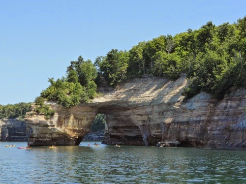
After checking some of the other campgrounds along the the scenic route to Munising, we decided that we probably wouldn’t move today. We discovered that is we want to see the Pictured Rock Cliffs, we could hike down to a couple of beaches and see the cliffs near them or by renting a kayak or we can take a boat tour and see 11 of the 13 miles of cliffs along the shoreline.  

P1010123

P1010130

P1010134

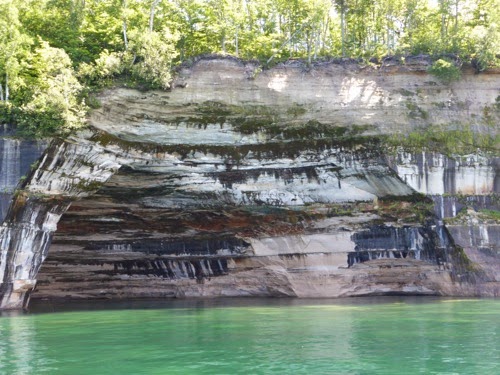
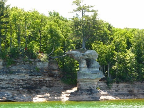
These cliffs are colored by nature on a daily basis.  Most of the rocks are sandstone which is very porous and allows water from the surface to seep through the rock.  As it exits the rocks it has picked up minerals like iron (red and orange), copper (green and blue), calcium (white), manganese (black) and tannic acid (brown).  These minerals stripe the rocks while the wind, waves, cold and heat shape the cliffs. One particular rock formation separated from the land had a lone white pine tree on top of it.  The only way this tree survived was its roots spanned the gap between its home and the shore.  At one time there were rocks to support the roots but now they look like a rope bridge across the span. On the return leg, we passed by a very old wooded light house on Grand Island. It was a beautiful ride on a really magnificently sunny and warm day.

P1010138

P1010153

P1010157

We rushed back to the campground so that we could hike 1.5 miles to catch the last tour of the day at the Au Sable Lighthouse.  Over 45 shipwrecks occurred along this shoreline between Grand Marais and Munising making lighthouses imperative, at least until technology made them obsolete.  Like other lighthouses we have visited, this one was also equipped to rescue floundering seamen after a wreck.  The water is very shallow for up to a mile from shore because of a reef and that is where most of the wrecks occurred.  Because the ship compasses were affected by all the iron ore they carried and the maps were not accurate plus most ships cruised close to the shoreline to keep from getting lost, storms had a way of pushing the ships toward land and grounding then sinking them.  If we had wanted to, we could have looked at some shipwrecks along the shoreline.  Scuba divers love wreck diving along here as the wrecks are generally only 15 - 50 feet deep. 

P1010162


P1010164

Wednesday, July 9, 2014

Hurricane Weather??

Not really hurricane weather but Hurricane Campground on the Hurricane River west of Grand Marais along the Shipwreck Coast on Lake Superior.  Now you know exactly where we are!

P1010118

We drove 70 miles up here from Tahquamenon Falls and stopped for lunch in Grand Marais (pronounced Mar - ay) which is a small village on the east end of Pictured Rocks National Lakeshore.  We had lunch at the brewery and strolled the two block business district.  We were fascinated by the Pickle Barrel House. It has a living room and upstairs bedroom in one barrel and a kitchen and bathroom in the connecting barrel. 

IMG 0571

Pictured Rocks National Lakeshore was the first lakeshore area to be named a National Park. There are three campgrounds at this end of the park.  The one we really wanted to stay in was already full so we took our second choice, Hurricane River.  The mosquitoes are HORRIBLE!  I had to wear my face net just to gather wood and build a fire!  We have tried two different insect repellents with little success.

P1010121

We took a short nature walk along the shore and enjoyed the peace and quiet of the forest with the waves crashing noisily in the background.  It is quite chilly today but promises to warm up for a couple of days soon.

Tuesday, July 8, 2014

Great Lakes Shipwrecks

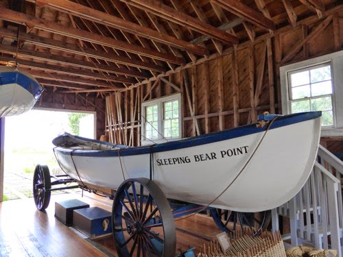
We woke to pouring rain this morning so the hike was postponed to later in the day and we visited the Great Lakes Shipwreck Museum in Whitefish Point.  This museum campus consists of the original lighthouse and keeper’s house, the building for the Lifeboat Station, the stations crew quarters, and the buildings for the museum, theatre and gift shop.

P1010108

The lighthouse placed here was the first one on Lake Superior in 1861.  The actual light house was originally brick and mortar which did not last through very many lake storms and icy winters.  It was replaced with the steel lighthouse we see today that we climbed up the damp slick stairs.  The Keepers house has been restored to the way it might have looked in 1890 and 1920’s when it was split into two apartments.

P1010106

P1010110

In 1923 the US Lifeboat Station was established at Whitefish Point when servicemen ran surf boats from shore into the storms to rescue those in peril along the Lake Superior coastline.  Once this station was started, loss of life went down by 90%.  Today this is the US Coast Guard.
P1010111

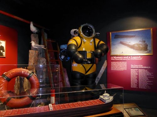
The theatre shows a 14 minute video of the dedication of the Memorial to the crew of the Edmund Fitzgerald which sank just 17 miles from here on November 10, 1975.  It lies in 450 foot of water.  A special dive suit and mini subs were used to bring up the ships bell and replace it with a new bell inscribed with the names of the 29 crewmen who died that night.

The museum goes into a lot of detail about the many ships that have sunk along this part of Lake Superior and, especially, the Edmund Fitzgerald.  And there were a lot of them!  This has been a very busy shipping lane over the years so as it narrows because it funnels into the Sault St. Marie Locks, many of the wrecks were due to collisions.  Others were from high waves and winds from winter storms on the lake and the rocky and shallow shoreline that was covered by fog or snow.
P1010117

P1010114

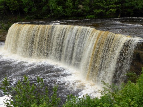
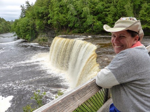
After lunch we tortured our bodies by hiking over 5 miles along the Tahquamenon River from the Lower Falls to the Upper Falls.  It is not the most difficult hike we have ever undertaken but it was strenuous with lots of mud holes, roots and rocks and steep inclines to walk over.  The Upper Falls drop 50 feet and are 200 feet wide and splash over 3,500 gallons of water a second into the basin. 

Monday, July 7, 2014

Tahquamenon Falls State Park

I dare you to try and pronounce this park’s name!!  ‘Tuh-qua-meh-non’ and it rhymes with phenomenon.  The second largest state park in MI and one of the most popular attractions.  The Upper Falls (which we have not seen yet) are 50 feet tall and the Lower Falls are actually a series of large rapids.  The water is a clear amber color due to the tannins leached from the trees and ground.  A unique feature of this park is Tahquamenon Falls Brewery and Restaurant.  The great-grandfather of the brew pub’s current owers sold the majority of his property, which included the Upper Falls, to the state of MI for $1.00.  In return he kept 2 acres where the brew pub now sits, right next to the parking lot for the upper falls.
 

P1010101

We got here about lunch time so by the time we set up, ate lunch, and napped we only had time for a 5 mile hike (as opposed to a possible 8-10 mile hike). There was a 1-mile trail from the campgrounds to the Lower Falls and then a 4 mile trail to the Upper Falls but by the time we had explored the area and then hiked we didn’t have time to do the whole thing and still make it to the brew pub for a beer before dinner.

P1010105

The area is very pretty, lush and green but the biggest drawback are the mosquitoes!  The locals say they are worse this year than in the past!  Supposedly we might see moose or bears in this area.

Sunday, July 6, 2014

Soo Boat Tour

Sault (pronounced ‘soo’) Saint Marie is the first settlement in North America, established by a French missionary about the time of Plymouth Rock.  The town sits on both sides of the Marie River that connects Lake Superior and Lake Huron so it is both American and Canada.  The Sault Saint Marie Locks help move ships over what used to be rapids that pioneers portaged around, taking up to 2 months to move goods from one lake to the other.  Today the locks help make that transition in 15 minutes.

P1010089

P1010096

We rode in the tour boat through the locks to the bay leading to Lake Superior, taking in the sights along the shoreline on both sides including a steel mill and a 1/4 mile long hydro-electric generating facility.  Three different container ships went throughout the locks during our tour, one was 1000 ft. long and 150 ft wide.  There are 5 locks but two are being decommissioned and one is for pleasure craft only but currently is closed because the railroad track is stuck and won’t lift up over the lock to let tall boats through. An automobile bridge and a railroad bridge span the river.  The car bridge is very tall but the railroad bridge has to be lifted four times a day to allow the tall ships to pass under it.

P1010098

P1010099

It was a gloomy and rainy day, so we didn’t miss out on biking or hiking. 

Saturday, July 5, 2014

Historic Mackinac Island

The ferry to Mackinac Island left at 9 AM sharp and we were on it ready to explore the only place in the world that has a state highway (M185) for bicycles and horse drawn carriages only.  No motorized vehicles are allowed on this island.  It has been a law since the horseless carriage was first introduced back in the early 1900’s.  The only one to make it onto the island scared the horses so badly that it was immediately banned. But first we rode under the suspension bridge connecting the Upper Peninsula to Lower Michigan. At 5 miles it was the longest bridge of its type in the world when it opened in 1957.

P1010065

P1010069

P1010076

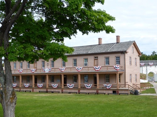
French soldiers first built Fort Michilimackinac in 1715, then the British took over in 1761 following the French and Indian War.  1796 was when Americans took control of the fort for the first time, the the British got it again during the War of 1812 but Americans got it back at the end of that war and have been here ever since.  It started out closer to the water and made of wood but then it was moved up the hill and constructed on rock and expanded many times.  We toured most of the buildings in the fort.  This fort was the 2nd National Park in the US but later it was given to Michigan and designated a State Park, their first.

P1010083

P1010085

Since we had our bikes, we followed the crowd on Highway M185 that encompasses the island for an 8 mile loop.  By the time we reached the west side of the island, the wind was so bad that we took off down the middle and up the hill.  When we came back down we were in front of The Grand Hotel so we paid $20 to walk around inside.  It is very plush, colorful, and elegant.  The sunny afternoon called for a gin and tonic sipped while basking in the sun, rocking away for a short nap.

P1010074

IMG 0569

By the time we got back into the business district it was wall to wall people!  We decided that it was time to go home and enjoy some quiet time, pay bills and finish the laundry. 

Happy 4th of July

Since the national park campground was booked solid for the 4th of July weekend, we had to move, so we drove up to Mackinac, crossed the bridge and are camped in a nice campground in St. Ignace on the Upper Peninsula.  Once we got set up we drove into town, a whopping one mile, and shopped, checked out the restaurants and then stopped at a bar for a gin and tonic.  On the outside, this restaurant and bar looked like one for the tourist and visitors but as we were enjoying our drinks it became very obvious that this was the local watering hole.  A lady sitting near us gave the bartender a wooden chip to pay for her drink so I asked about it.  She said that if anyone wants to buy you a drink they pay the bartender and then you get the chip to use on your next drink. 

P1010063

IMG 1290

The 4th of July is not the 4th unless there are fireworks and especially fireworks over Lake Huron.  So we bundled up, grabbed a couple of chairs and headed to the beach around 9 PM.  This being further north than Missouri, it gets dark later in the day.  We sat for 1 1/2 hours waiting for the fireworks!  Long before the local show started, the towns on down the lake and over at Mackinac Island were shooting off their fireworks as well as our friends on the beach.  At 10:30 the show started and by 11 PM it was over and we were in the Jeep getting warm!  It was down right cold out!

Thursday, July 3, 2014

Sleeping Bear Biking

Enough hiking, today we rode our bikes. 

After exploring the whole campground, we rode our bikes over 2 miles down the road to where the Platt River empties into Lake Michigan.  Right next to the national park parking lot is a county park and you have to pay if you park in either one.  The park is so quiet and peaceful with the gently flowing river passing by on its way to the lake.  That jaunt put 8 miles on our bikes.

We drove to Glenn Arbor and got on the Sleeping Bear Heritage Trail and rode to the Dunes Climb parking lot and then back for lunch in town.  Add 8 miles.

After lunch we drove to Empire, took a nap in the car, and then rode the bikes on the other end of the trail, riding another 9 miles. That left 1.5 miles we did not ride on the Sleeping Bear and 25 miles on our bikes. Those last 9 miles were brutal!   We climbed a 9%, a 10%, and a 7% grade. I almost walked, I was so tired! 

Today was cool (65) but sunny and this evening was just about perfect for a campfire and a glass of good wine. 


Wednesday, July 2, 2014

Glen and the Dunes

Sounds like a children’s story, doesn’t it?  We visited Glen Lake, Glen Arbor and Glen Haven and then visited Sleeping Bear Dunes, hiked on Cottonwood dune, and drove on a scenic dunes road called Pierce Stocking Scenic Drive.

P1010053

P1010048

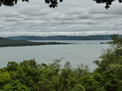
Glen Lake is split into two parts by the highway  - Big Glen Lake and Small Glen Lake.  The big lake is large and very deep while the small lake is only 12 feet deep.  Both are lovely clear blue and lined with homes.  Glen Arbor is a small village at one end of the lake with numerous shops, restaurants and artist studios.  

P1010050

Glen Harbor Historic Village was first a port for the steamships on Lake Michigan from 1865 - 1931 but grew with the building of a cannery for the various fruits grown in this area.  Then the US Lifesaving Service chose this spot to help rescue men from sinking ships.  This later became the US Coast Guard. Lake Michigan is very shallow along this coastline due to the sands so most of the rescues came from the shore rather than by boats.  The rescue team would haul their equipment wagon out into the surf, shoot a Lyle canon with a weighted rope out over the wrecked ship and then rig a zip line with which to haul the men into shore.

The whole village is a museum with a General Store and working Blacksmith shop, boat museum, and the Lifesaving Service house with their boats and rescue equipment from the turn of the century.

P1010057

P1010058

P1010060

P1010061

The Pierce Stocking Scenic Drive was a 7.5 mile loop that took us past the Dune hike where one could climb several large dunes on the side away from the coast, and then we watched lots of foolish people run down 450 foot Sleeping Bear Dune to the lake and then have to crawl back up.  But the view of the coastline was stunning.  We also took a short 1.5 mile hike into the dune field to experience the changing landscape at the edge of the dunes.

Tuesday, July 1, 2014

Sleeping Bear Dunes National Park

I guess I should have been collecting National Park coins or stamps since we have been visiting a lot of them on our adventures.  This will be the 3rd park this year.

We only had to drive 40 miles today as we didn’t realize the park was so close to where we were camped in Manistee.  Shortly after lunch we drove to the visitor’s center, got some information about the hiking and biking trails and then took a 4.7 mile hike through the meadows and pine-hardwood forests around Otter Lake.

IMG 1279

As are most National Parks, this one covers a huge amount of territory.  We had to drive 12 miles just to get to the visitor’s center from our campground.  If we want to ride our bikes on any of the biking trails we will have to put them on the Jeep and drive to the trail heads. The section of the park where the actual sand dunes are located will be another 8 miles from the visitor’s center and the park stretches another 15-20 past the dunes.

We did get to enjoy a nice campfire this evening.

Monday, June 30, 2014

Shrine of the Pines

In the early 1920’s, R. W. Overholzer determined to create a memorial to the white pine tree, the Michigan state tree.  He and his wife lived in a small white clapboard house near Baldwin when he started this project but they had to build a new log home to contain all the many pieces of furniture Mr. Overholzer crafted.  His home was eventually given to the state.

He sought out white pine logs, tree stumps, whole root systems and whole trees and crafted them into many various pieces of furniture using only his hand tools. He smoothed out the logs with glass, used sandpaper and raw deer hide.  His rule of thumb was that it had to be done by hand and it could not cost him any money.  Everything you see in the pictures was made by him.  Some things like the wood inlayed table and the chairs around it took over 8 years to build. The table, legs, drawers and all came from one 700-pound stump.  Most tables, cabinets, beds and dressers are from only one log each which he carved or hollowed out and smoothed. He used no metal fasteners and no varnish.

P1010043

P1010045

P1010046

The rest of the day was spent exploring Ludington, grocery shopping and preparing for the rain storm.

Sunday, June 29, 2014

Bear Lake Golfing

I have golfed at Bear Creek (at the Lake of the Ozarks) and now at Bear Lake, MI.  What’s next?  Bear River? Bear Bog? or how about Bear Back?  

I talked John into playing golf with me today after it quit raining this morning.  We drove up to Onekama (pronounced O-neek’-a-ma) and enjoyed the scenery along Lake Michigan then after a picnic lunch on Portage Lake (looks like a large bay off of the Lake Michigan) we went inland to Bear Lake where we found a really nice but inexpensive golf course.  It had turned into a beautiful day, despite the wind the course was lush and green but none of that helped our games in any way.  We are too embarrassed to reveal our scores. Although it rarely happens John did score better than me.

We stopped at a roadside bar for a cold bear and one of the patrons told us we HAD to have dinner at Glenwood Inn in Onekama!  He was right on!  We had a great meal and a great dining experience.  We highly recommend this place if you are ever in Manistee County, Michigan.