Showing posts with label New Hampshire. Show all posts

Sunday, September 9, 2018

Covered Bridge

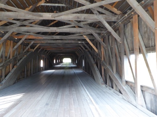
In the process of driving from Franconia to Hershey, PA we traveled across the rest of NH and into Vermont and then to Cooperstown, NY.  But just before we got to the Vermont border we drove through this cute little town of Bath and were surprised to see a covered bridge.P1040642P1040643P1040645
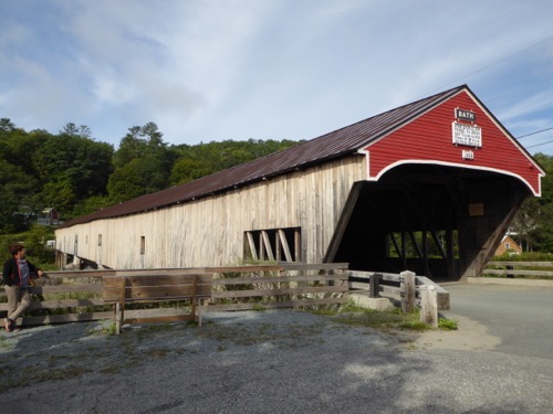
According to the sign it is the longest covered bridge in NH and one of the oldest bridges since it was built in 1832 and has stood the test of time with only one restoration in 1988.  This bridge is known to locals as The Kiss’n Bridge.  We also stepped into a quaint country store before continuing our journey.

We plan to hunker down in Cooperstown for 2 nights to avoid driving in a massive rain system that is predicted to last more than a day. We’re guessing it’s the same storm that apparently dumped upwards of 6 inches on our home in Missouri.

Saturday, September 8, 2018

Cascade Trail to Lonesome Lake

Today is the day for our ‘Big’ hike!  Unfortunately it is Saturday and everybody and his brother is out hiking on this beautiful day.  There was zero parking available at our planned hike so we went to Plan B and this turned out to be the best option.P1040638P1040639IMG 7401P1040640

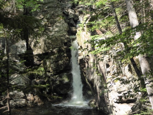
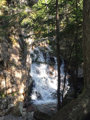
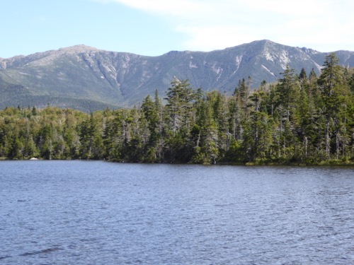
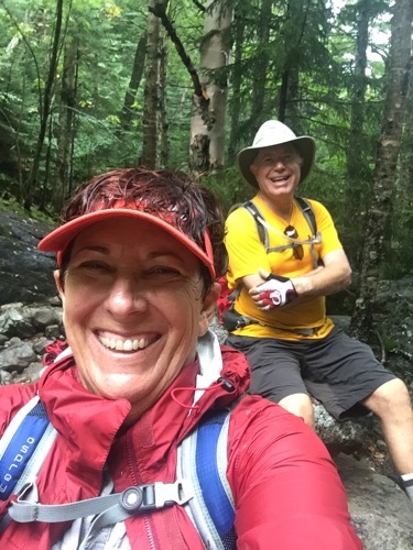
Our hike started at The Basin where the Pemiwassoc River flowed over a ledge and created a 15 foot deep basin. The trail traveled up the side of the mountain, through deep forests and along a cascading river flowing from Lonesome Lake.  Along the way were several nice waterfalls like Kinsman Falls and Fallen Rock Falls.  The trail was covered with tree roots that wanted to trip us, then boulders that we had to walk on top to keep our feet dry.  We had to cross the river at least twice by jumping from rock to rock.  But the last one mile was the hardest as we literally walked over, around and on top of boulders the whole way up and then the whole mile back down. But Lonesome Lake was beautiful with the Lafayette and Lincoln Mountains as its backdrop. This is a 6.4 mile hike with slightly over 1,100 feet of vertical climb, but it sure felt longer!

To celebrate that accomplishment, John took me out to dinner!  Tomorrow we head south starting our homeward trek, especially since there are freeze warnings here for tonight.

Friday, September 7, 2018

Mt. Washington on Crawford Notch

A Notch is really a valley between two mountain ranges and was named that after settlers notched trees to mark the route through the mountains.  Along Crawford Notch are the Presidential Mountains - Mt. Adams, Mt. Jefferson, Mt. Eisenhower, and Mt. Washington, the tallest mountain in the Northeast at about 6300 feet.P1040637P1040618P1040620P1040621

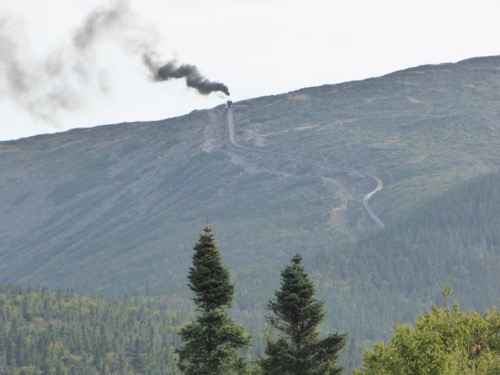
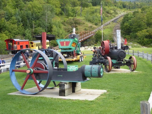
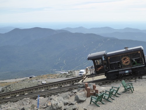
Sylvester Marsh got the idea to build a railroad up the mountain to make it easier for tourist to get to the top.  He proposed his idea and requested permission from the state legislature in 1866 to build this railroad and they laughed at him and said as long as he was going to build a railroad up the mountain he might as well build one to the moon!  The cog is a big toothed wheel in the center of the engine that moves up a slotted track and pulls the train up without letting it roll backwards.  The engine pushes the passenger car up and leads the car down.  The first engines were steam but now they use bio-diesel engines except for the first run of each day they use a steam engine.P1040623P1040624P1040628P1040630P1040633
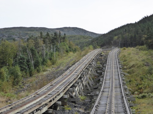
Parts of the track are at a 37.4% grade as it winds its way straight up the side of Mt. Washington. At the top is a visitor center and a weather station that is manned year round.  Winds of hurricane force are not uncommon with an average velocity of 37 mph and with temperatures of minus 40° or lower there is 177 inches of snowfall.  The highest wind was 231 mph in April,1934. The warmest it has ever gotten is 74°.  The ground is permanently frozen.P1040635

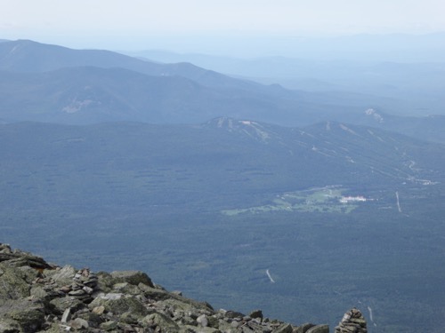
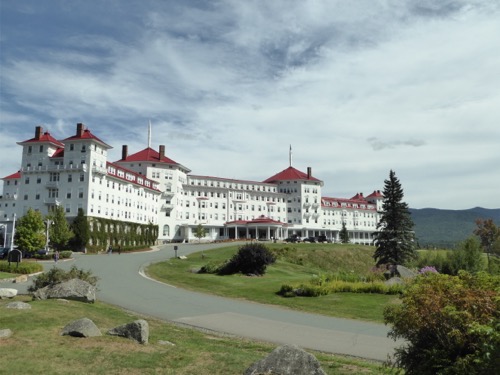
At the bottom of Mt. Washington is the Mt. Washington Resort and Golf Course.  We walked through the enormous lobby and contemplated champagne on the porch while watching a train climb the mountain but drove over to the golf course instead.  We did not play but did shop for shirts & hats but found nothing to our liking.IMG 1751

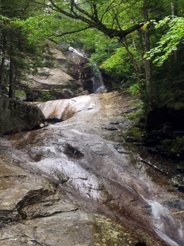
Just down the road from the Cog we found a ‘short’ hike. Kedron Trail left the Willey House and was supposed to be .75 miles up to a waterfall.  We had no poles and thought it would be an easy, short hike.  Were we ever wrong!  It was steep, narrow, rutted with tree roots and boulders. If we hadn’t gotten to the waterfall when we did we would have just turned around and gone back down with nothing to show for it.  And our FitBits said we walked over 2 miles!  I rewarded our efforts with a scoop of Moose Tracks ice cream!

Thursday, September 6, 2018

Bridal Veil Falls

The weather in the mountains can be unpredictable and the weather forecasters are very often wrong!  We knew it was predicted to rain today but we thought it would be this afternoon so we wanted to get in a hike before it got wet.  The campground host had given us several ideas and loaned us a big book full of trail descriptions.  Bridal Veil Falls was just on the other side of the mountain from the campground, was supposed to be only about 4.5 miles long with not much elevation change.  It would be perfect for the first day of hiking after being fairly inactive. 

IMG 7373IMG 7371

And it was a pretty hike through forest and along a burbling brook, up a gradual hill on a trail of pine needles, leaves, moss, mud, large rocks, and roots!  Yes, it got steeper and then it rained!  We were prepared with rain jackets in the backpacks and it was a very warm day so the rain felt good for awhile. It poured down for a short time then tapered off just as we arrived at the falls so we could take pictures without worrying about the camera getting wet. Then in poured again.  There was a backpacker's shelter at the falls that we sat in for a while hoping the rain was almost over but it wasn’t.  Impatient, we started back down in the rain.  By the time we got to the Jeep it had quit again but we were drenched from head to toe!IMG 7377P1040617

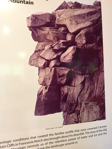
Hot showers and a nap were needed!  We then drove down the Franconian Notch to Lincoln to have dinner. Along the way we stopped to see The Old Man on the Mountain, an iconic rock structure that used to be at the top of Profile Mountain.  It was a series of ledges and rocks that looked like a man’s face when viewed from a certain direction.  Unfortunately about 15 years ago it fell down!  So instead of trying to rebuild the rock face they have created a plaza with several tall poles with a rod at the top pointing to the mountain.  On the rod are a series of protrusions that recreate the face when you look along it towards the mountain with one eye closed. We had dinner at a very nice restaurant called “The Common Man” but before dinner we found a dive bar for a cocktail.  That’s always an interesting experience.

Wednesday, September 5, 2018

Back in the USA

Labour Day in Canada is just like in the US - picnics, camping, day trips with family.  We took that day to write blogs, balance the checkbook, pay bills, take a walk and then dine out at a very nice restaurant.

Tuesday we crossed back into Maine and spent the day picking up our mail and prescriptions, grocery shopping and washing the RV and Jeep. 

Wednesday we visited with our wagon master, Jim and Cherrill, before pulling out and driving to Franconia, NH in the White Mountains. It was a lovely but short drive.  We wanted to stay in the state park but it was full and we discovered later that we would not have been able to squeeze our RV into any of their campsites.  We did find a nice private campground, Fransted Family RV Park, that was very handy to the state park.  After we got set up we drove around the area just to check out things to do and hikes to plan.