Friday, August 31, 2018

City Tour and Reversing Falls

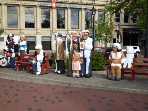
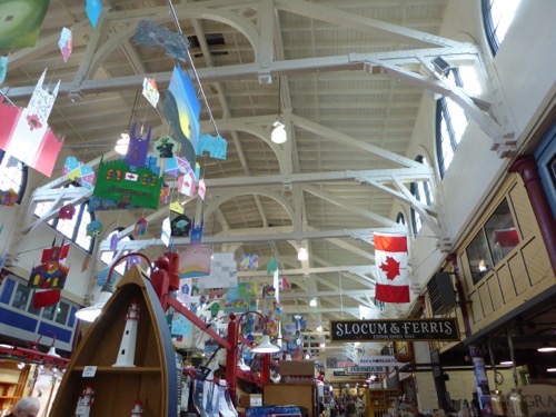
The Caravan tour is winding down as this is the last day.  The city tour took us to many of the same places we walked around yesterday but we got a little more information about what we were looking at.  Homes in the Heritage District must maintain the look of the late 1800’s.  The guide pointed out the former homes of Walter Pidgeon, Louis B. Mayer (of Metro Golden Mayer) and Donald Sutherland. We shopped at the Old City Market and then visited some of the small city parks and other neighborhoods, including the guide’s home.P1040598

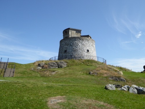
The Carleton Martello Tower  is a National Historic Site. The tower was built by the British during the War of 1812 but not completed until 1815 when the war ended.  It was used to protect the harbor and town during WWI and WWII but mostly it was neglected until made into a Historic site.  It is being renovated so we could not go inside.P1040597

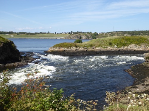
No visit to Saint John is complete until you stop to see the Saint John river change direction and flow backwards.  The tides in the Bay of Fundy are so high and strong that when the bay waters meet the river it actually forces the river water back up stream until the tides turns.  If one has patience you can see the river flowing down stream then it stalls as the tide rises and then it flows backwards.  

This evening was our farewell dinner and party.  The dinner was nice but the party afterwards was better.  We gathered outside around the TV at Mellow and Janet’s RV and watched a slide show that Mellow had put together about all the things we had seen on this trip.  Then Pat and I led the group in a song that Pat wrote to the tune of “God Bless America”.  She is quite the poet.  Cathy and Bill put together a little piece of prose about each person on the trip and some were quite funny. Like Barry having too many Hot Rum toddy’s and dancing, me and a name change, Janet being too cold and Conrad’s tire thumping to name just a few.
Thursday, August 30, 2018

Saint John

You may be confused by the name of this city.  We did visit St. Johns in Newfoundland but this is Saint John in New Brunswick.  It it the largest city in NB with about 125,000 people in the metro area.  We are camped in the city park - Rockwood Park.  It too is the largest municipal park in North America, two times bigger in area than Central Park in NYC. The campground is mostly a parking lot with nice grassy areas around the edges.P1040590P1040591

Since it is relatively close to the downtown area, John and I walked down the hill, across the interstate, through a kind-of rough part of town and into the Old City Market, built in 1876.  A large number of the downtown buildings are connected by an enclosed pedestrian walkway but we stayed outside and walked several city blocks in all directions.  I enjoyed looking at all the old buildings and unique architecture while John was more interested in the restaurants and bars and there are lots of places to choose from.  We first partook of wine at a very nice wine bar and then had dinner at “Italian At Night” restaurant.  Fabulous dinner!

But then we had to walk up a very long hill to get back to the campground.

Wednesday, August 29, 2018

Moncton & Flower Pots

It was another short drive today so we stopped in Moncton and rode our bikes on one of their trails.  This one ran along the Petitcodiac River which is at the north end of the Bay of Fundy. As we reached the end of the trail we realized that the tide had turned and was coming in fast and furious.  We could see waves of brown, silty water moving up the river.  Within minutes we could tell that the water was rising.  As we rode back towards the city, John paced a rapid in the river at 7.2 mph. We found out later that the river is just a few feet wide and only 4-6 feet deep at low tide and over 1 mile wide at high tide and 160 ft. deep. This happens twice a day, every day.P1040554P1040563P1040583P1040589

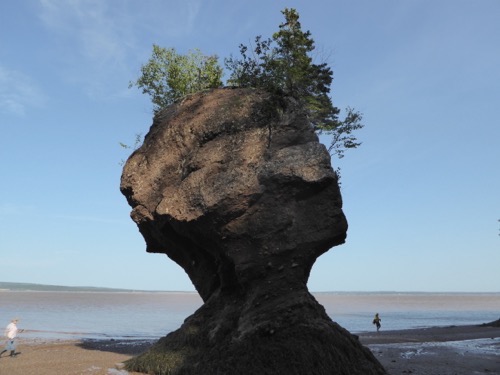
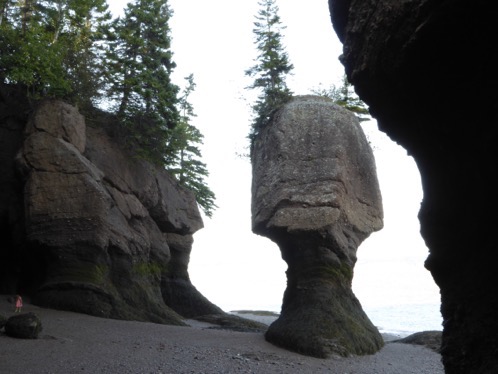
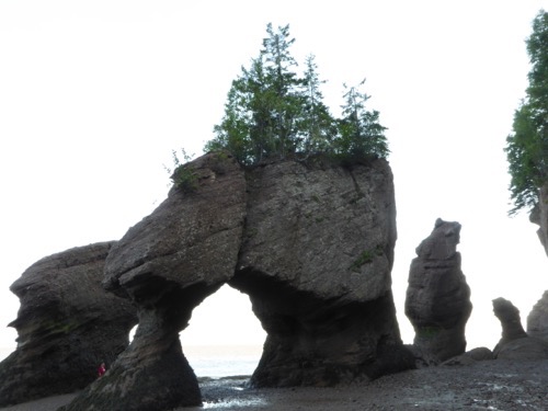
Because low tide was around 7 pm we got a guided tour of the Hopewell Rocks Provincial Park starting at 5 pm.  The water was pretty close to the shore line but receding quickly.  At the end of the talk, 1.5 hours later, the water’s edge was over 40 yards away.  The ‘flower pots’ are rock towers that look like small islands when the tide is in but like pedestals with trees and grass on top when the tide is out.  The trees along the shoreline are quite old.  One tree, sticking out from the rock at a 90* angle, was 170 years old and had been growing at that angle for over 70 years.

Tuesday, August 28, 2018

Made in Nova Scotia

Since it was a relatively short drive to Truro today, we stopped in Stellarton to visit the Museum of Industry in Nova Scotia. The displays started with the use of water power and worked up to steam power, locomotives, model trains, iron and steel and automobiles.  Then we learned about making glass, sawmills and electric power.  P1040549P1040551

Coal mining was a huge industry in this area.  The exhibits on mining were well done but the cost of life in the mines was very high due to explosions and cave-ins. Even so, the men seemed to love their work and were upset when the mines had to close.  Altogether a very interesting display.

The trip is winding down with only a couple more stops before we have to say goodbye.

Monday, August 27, 2018

Fortress of Louisbourg

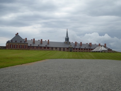
P1040521P1040522This afternoon we toured the Fortress of Louisbourg National Historic Site.  The French came here in 1713 after ceding Newfoundland to the British.  This site was situated such that it would be useful in protecting PEI and Cape Breton from invaders as this was a rich area for cod fishing on the Grand Banks.  Louisburg became a hub of commerce and trading with France, Quebec, and New England. They had just finished building the last houses in 1745 when England again attacked and won the city. It was given back to the French in 1748 but the British won it back again in 1758 when they destroyed the fortress walls so it could never again be a fortified French base.P1040524
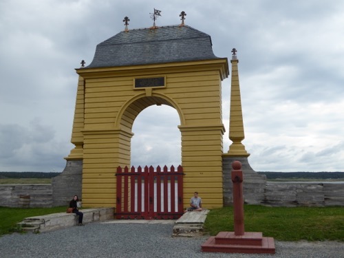
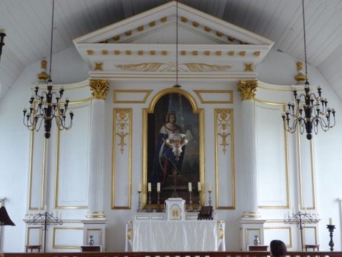
In 1961 the Canadian government began a $25 million project to rebuild the city on it original foundations.  To date only 1/5th of the city has been completed. The most prominent building is the King’s Bastion Barracks, Governor’s Apartments, Military chapel and guard house surrounded by a rock and dirt wall.P1040532P1040535P1040540
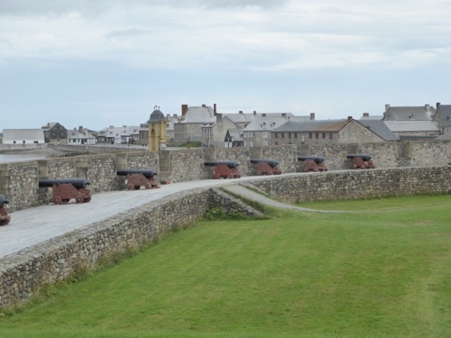
Other buildings include rich man’s residence and servants homes, storehouses, barns, shops, cafe, hotel or inn, stables and theatre.  The town was built right along the sea so there are several gates where wharves were located and a demi-bastion with cannons.  P1040525P1040526

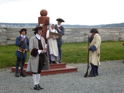
Shortly after our arrival a mob had gathered to see that a young lady who had stolen some items from her boss was publicly humiliated by forcing her to stand at a post with an iron collar around her neck for two hours a day.  She didn’t seem very concerned!  The costumed residents explained about life in the 1700’s, made bread, forged iron, danced, sewed, made lace and worked gardens.  We even experienced the shooting of a cannon and rifles.P1040541P1040547

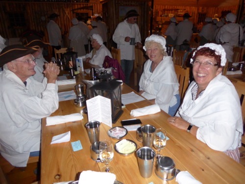
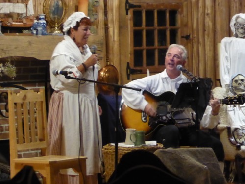
Following our tour we enjoyed a fun evening dressed as beggars and dining on snow crab and lobster while being entertained by musicians and a lady of the evening.  I even got to sing in front of the crowd! It was a very lively evening!

Sunday, August 26, 2018

Grand Codroy to Port-aux-Basque

P1040520We caught up with the rest of the caravan on Saturday in Grand Codroy just in time to enjoy a pot luck dinner and games.  We did have a short time to explore the area and had a nice drive around the bay and out to the Cape Anguille Lightstation, the most western lighthouse in Newfoundland.  We almost stopped at a tiny little truck for a local hamburger but I talked John out of it.
Sunday we bid a fond farewell to Newfoundland as we boarded the ferry for the short six-hour ride back to North Sydney to stay at the Arm-of-Gold Campground again. We are so disappointed that we only glimpsed one moose about a week ago and saw no others.  We did see a lynx and that was special. 

Friday, August 24, 2018

Table Lands and Baker's Brook Falls

It was raining so yesterday was a good day to stay in and do nothing or just catch up on ‘stuff’ like paying bills and writing blogs.  We did get out to take a short hike on the path to Gros Morne Mountain.  We allowed ourselves an hour so we turned around just short of the base of the mountain where it would start getting steep.  It was a good thing we did as the mountain top was covered in clouds. But it was a quiet walk through rain forest full of ferns, moss and mushrooms.  But no moose.P1040516

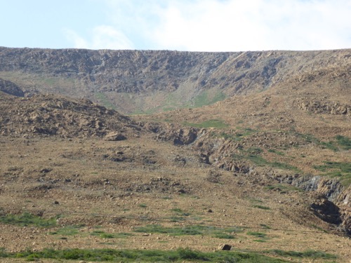
Today we drove about an hour around the East Arm and the South Arm to take a hike on the Earth’s mantle.  Our park ranger guide taught us (or tried to teach us) about the geology that caused the earth’s crust to split apart, the tectonic plates shifted and then forced some of the inner materials to squeeze out on top of the crust. It has only happened in about 3-4 places in the world. The mantle is so acidic and dense that nothing will grow here and its been around for millions of years like this.  What plant life we see is due to human intervention.  

Before the hike on the mantle we did explore the town of Trout River and the actual Trout River itself.  One couple from the caravan, David and Betty,  took a zodiac boat ride up the river and then walked back with a ranger.  They said it was beautiful and informative. P1040517

We tried to hike on the Lookout Trail to get a view of the Arms and the Gulf of St. Lawrence but it was closed so we drove back to Rocky Harbor and hiked the Baker’s Brook Falls Trail which turned out to be the most uninspired walk we have taken in a long while.  I would guess that 90% of the trail was a board walk through low-lying marsh and bog.  At the end of the trail was a spectacular waterfall that made the boring walk worthwhile.  The waterfalls and the 6 miles of walking were good but still no moose.

As a reward for all those steps we had a delightful and delicious dinner with Janet and Mellow at the Black Spruce.  We would highly recommend it.

Wednesday, August 22, 2018

More Hikes in Gros Morne

Gros Morne means Big Small Rounded Mountain but can also mean Big Isolated Hill or Big Gloomy, Dismal Hill and all would be correct depending on the weather.IMG 7254

The first and second hikes were with Mellow & Janet and David & Betty.  The first was only about 1/2 mile long but it took us to the top of Berry Hill.  This hike lived up to its name as we picked wild raspberries and saw blueberry plants and crow/ghost/bunch berries.  The second hike was around Berry Head Pond. Pond is another word for Lake in Newfoundland.  This was only about a mile but we enjoyed stopping to look at moss, lichen, mushrooms, flowers, berries and trees.  We also found a beaver lodge but no beavers.P1040513IMG 7257

After a picnic lunch we drove over to Lobster Cove Head Lighthouse which had several short paths to some scenic overlooks.  Then John and I found the Coastal Trail with cobble beaches and tuckamore forests.  These are evergreen trees that are stunted by the wind and snow and bunched together so tightly one cannot get through them. A light mist sent us back to the car.

We drove through Rocky Harbor then out to Norris Point researching good dining establishments.  We found one for dinner then we joined the caravan at a pub for the Anchors Aweigh show.  It was a rollicking, funny Newfoundland band playing folk songs and jigs.   We tapped toes, laughed and danced a jig for a very fun evening.

Tuesday, August 21, 2018

Gros Morne National Park

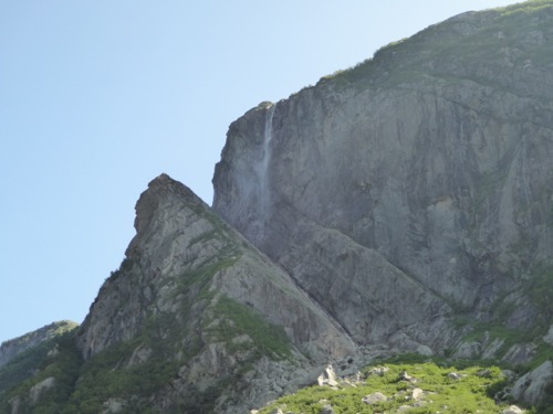
We left at least an hour earlier than most of the others in our group so we could stop at Western Brook Pond to take a boat ride.  Actually, we had to hike 3 km to reach the boat dock.  The Pond is really a huge lake that was created by the retreat of glaciers 15,000 years ago.  At one time it was a fiord but as the ice moved away, the land heaved a sigh of relief and rose up, cutting off access to the ocean.  The lake is so deep (over 160 meters) that it takes 15 years for it to refresh itself.  And because of that it has very little vegetation or fish and is crystal clear.  The two hour boat ride took us 16 km to the very end past high 650 meter tall cliffs, long waterfalls, and rock slides. One water fall was named Pissing Mare.  I think I would have named it something nicer like Bridal Veil!P1040501P1040508P1040493P1040510

Three kilometer hike back, find the RV park and then we had dinner with Janet and Mellow.  David and Betty joined us later so we could plan our adventures for the next three days.  The caravan will leave on Thursday but the three couples will stay an extra day to enjoy more of the park.

Gros Morne is a UNESCO World Heritage Site due to its geology.  We hope to hike on the Earth’s Crust which was pushed into place when the continents collided billions of years ago then shaped by the glaciers 15,000 years ago.

Monday, August 20, 2018

Discovering the Vikings' Visit

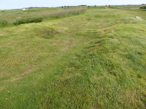
Over 1,000 years ago, Leif Eriksson left Greenland and sailed west where he landed on the northern peninsula  of Newfoundland.  There he set up a base camp from which they could explore the area further south, some feel as far south as New Brunswick looking for hardwood, furs and grapes for wine. They built turf walled buildings that served as over-wintering quarters with houses for all the crew, a forge, storage for supplies, rooms for women and servants.  They used this site for perhaps 20 years but burned it down and went back to Greenland when they couldn’t afford the expense of this settlement.  Fast forward to 1960 when interest was high in discovering if the Vikings arrived before Columbus. An archeologist had read the sagas and knew there had to be a settlement site somewhere on North America. When he visited NF he talked with a local fisherman who told him about the Indian ruins.  A short time later he found some small artifacts that proved the Norse had lived here. We call them Vikings but that term applies to Norsemen on a raiding expedition.P1040451

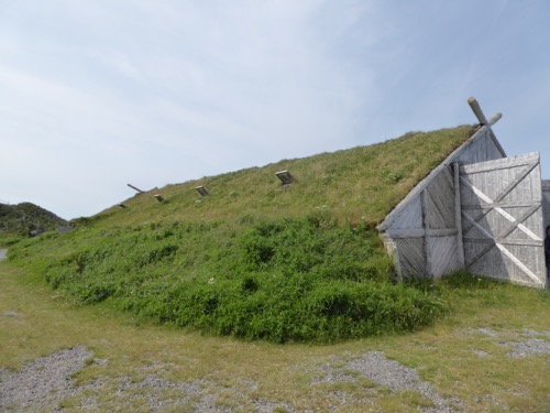
L’Anse aux Meadows National Historic Site is the name given this settlement and it means Point of Meadows. It was designated the first cultural UNESCO World Heritage Site.  The actual locations of the original buildings have been marked off and preserved by allowing them to be overgrown but they have built exact replicas so that visitors can get a good idea of what life would have been like in the 9th Century.P1040455P1040459P1040462

The large hall would have housed the crew and dining hall.  Other houses were for the more important crew members, a hut for servants, and a hut for the women to work on weaving and living quarters.  Another large hall was for the commander, Leif, and his command personal and held a banquet room and storage for supplies and boat repair.  There was also a smelting hut where they extracted iron ore from the bog ore but only enough for 200 nails.P1040466P1040471P1040472P1040473P1040477

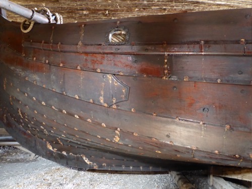
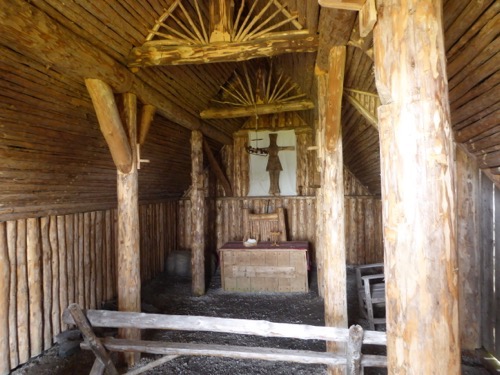
Our next stop was another reconstructed Viking Village.  This was a commercial site and included an authentic church and Norse boat showing the details of where iron nails would have been used, the size of the mast and sail and the tonnage of the ship.  Including ballast, cargo, crew and crew supplies the ship would have weighed over 35,000 tons and still sat high in the water.

During the afternoon we learned about a very important Newfoundland Labrador doctor who came here in 1892.  Sir Wilfred T. Grenfell couldn’t believe the poverty and diseases the people of the North Peninsula endured.  They were sick with TB, scurry, beriberi and malnourished as well as living with inadequate clothes and housing.  He went home to England, gathered supplies and funds and came back to help these people.  His first hospital ship treated over 900 people in three months time. He eventually moved here, married, had three children and was the driving force to build hospitals, schools, orphanages, nursing associations and training centers.  He also showed the people how to help themselves by creating crafting enterprises where they could make and sell their crafts.  He also helped the fishermen to unite and get rid of the fish mongers who were robbing the people of their income.P1040482P1040486
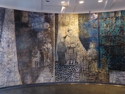
Mr. Grenfell’s home is a living museum and a mural in honor of the Grenfell Foundation is installed in the entrance of the local hospital.  The mural is made of ceramic tile and surrounds the rotund reception area.  It was created by Jordi Bonet.

To end the day we enjoyed a Viking Feast with local foods such as brewis, moose stew and salted beef.  

Sunday, August 19, 2018

Whale Hunting

P1040447Most signs state “Whale Watching Tour” but our naturalist insisted it is more of a “whale hunting tour” as they cannot determine exactly where the whales are running although they have a pretty good idea as they have spotters on the points and in the ocean as well as all the passengers on the boat. P1040431P1040439P1040442

During our 2.5 hour ride we spotted at least three Fin Whales and several pods of Atlantic White Beak Dolphins, four puffins floating on the water and numerous gannets and murres flying overhead.  Fin Whales are among the largest whales on earth reaching up to 60 feet long which was almost twice the length of the boat we were on.  They would surface 3-4 times then on the last time they would bring their whole body above the water line and then dive for up to 15 minutes before coming back up again.  One Fin Whale was on a mission and actually left a wake as he swam past us.  Some of the dolphins swam with the boat and one pod of dolphins were in a mood to jump out of the water and splash back down (called breaching) many times in a row.  That was very fun to watch.P1040427

Look close you can see the wooden steps.P1040448IMG 7211

This afternoon we tackled the Dare Devil Trail near the Fox Point Lighthouse. Over 475 wooden steps climb up 500 feet to the top of the cliff.  Once we caught our breath we walked along the ridge top enjoying the view of the Atlantic and one of the coves we cruised in this morning.

Today is our 46th anniversary so we went to dinner in Straitsview (or it might have been St. Lunaire or Quirpon or possibly Griquet - they all run together) where we dined on snow crab and scallops.  A few of the diners got excited about something out side so we looked also and there was a lynx walking on the lawn.  He was very curious but didn’t stick around very long.  What a beautiful creature!  

We drove on down the road a ways to check out the village and decided to stop at Skipper Hot’s Lounge for a night cap.  A live 3-man band was playing Newfoundland tunes (the rhythm guy was playing the ugly stick) while a few ladies danced jigs. Such a neat experience!

Saturday, August 18, 2018

Where is That Squeak?!

Since we have such a short drive up the coast to St. Anthony, we took our time getting ready to depart St. Barbe. Along the way a very annoying squeak in the RV door drove us to distraction.  We’ve been battling this noise this whole trip and have "had it up to here" with it.  John has tried making the door fit looser, fit tighter, added cushions, taken the cushions off, and I have pushed and pulled on the handle trying to figure out what is causing this squeak!  We stopped along the route at least three times and we still don’t know what is causing it to squeak!P1040440We spent the afternoon driving around the town, shopping in gift shops and a hardware store/housewares store, and exploring the docks and neighborhoods.  Its a pretty town which we’ll learn more about in another day or two.

Friday, August 17, 2018

A Short Visit to Labrador

IMG 7181Our campground is a short 5 minute walk from the ferry dock but at 7 am it seemed longer and it was definitely cold this morning (49°)!  We boarded the ferry, found some comfortable seats, got a cup of coffee and enjoyed a smooth 90 minute sail across the Strait of Belle Isle to Blanc Sablon, Quebec.  Just a half kilometer later the bus had us in Labrador and on our way to Red Bay, another 90 minute ride.

Along the way our guide, Cindy, gave us a little history and information about Labrador.  This Provence joined Canada in 1949 along with Newfoundland. Within ten years they had paved roads!  Their population is only about 30,000 people with the majority living along the coastline. Their main industry is fishing, of course, with tourism coming next.  They used to get a lot of snow but with the climate changing the way it is, it has been very unpredictable as to how much snow they will have each winter.  P1040411

The Basque from France and Spain originally came to this area in the 1500’s for whaling and cod fishing.  They didn’t settle the area, just lived here during the whaling season, then when winter approached they would take the whale oil, baleen and whale meat and head back home. At that time each barrel would bring $6-10 thousand dollars and each ship could carry up to 300 barrels.Thats a lot of oil and money.  French fur traders settled in the area beginning in the late 1700’s because of the seal furs.P1040413

Near Red Bay an ancient burial mound was found with the body of a child preserved by the layers of sand and rock packed around it.  He was buried with numerous tools and covered with red ochre.  Scientist estimate he was put there about 7,500 years ago.P1040425P1040419

Rocks are called Archaeocyathids.IMG 7190

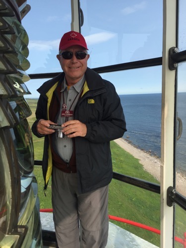
Of course, being on the coast of the Strait of Belle Isle which is an entry into the Gulf of St. Lawrence, there is a lighthouse.  L’anse Amour is French for Point of Love but they think it might originally have been Amort which is Death.  They like Amour better! The lighthouse is very necessary as many ships have sunk in these waters due to fog, wind, storms and rocks. We climbed to the top for some great views of the ocean and land. The walls of the lighthouse are over 6 feet thick at the base where winds and waves could pound on the structure. The waves can reach up to 30 feet high. 

Our last stop before boarding the ferry back to Newfoundland was a restaurant where we had pizza and wings and beer.  Great way to end a long day day!