Wednesday, August 31, 2016

Huckleberry Ridge

Since I was feeling better on Tuesday morning we got ready to ride our bikes as soon as it warmed up some - so late morning. I relented and told John we could do the moderate to difficult trail called Huckleberry Ridge. What that means is that the trail was at least two tracks wide with little elevation change for the first couple of miles then as we got to the lake’s edge the trail narrowed to one track, started to ascend the ridge and was filled with tree roots and boulders! I may be exaggerating a bit. The trail description said that only 10% of the trail was difficult and what that meant for us was walking the bikes over tree roots and boulders for over a mile! There I go exaggerating again - but not much! Once we got to the end of the Ridge Trail, we rode on the gravel road to the point on the peninsula. But the observation point was up a steep, loose gravel road that I just could not handle, so John went alone. Getting back was easy!

P1000768

P1000769

We had a late lunch, took naps and had dinner in town.

Today was Farmer’s Market Day in McCall. It was not a large market but it was well stocked with vendors selling vegetables, fruit, apples, eggs, meat, fresh cut flowers and other non-food stuff like jewelry and pottery. I got eggs, honey, lettuce, tomatoes, green beans, lemon cucumbers (small yellow ball sized cakes), blackberries and local lamb chops.

We explored the other state park camp site, took a long walk on an easy trail, John built a roaring fire and dinner tonight was totally from the market! Good Day!

Monday, August 29, 2016

Bonanza!

We are currently camped on the Ponderosa! No not the ranch, but the Ponderosa State Park in the Payette National Forest. The Ponderosa Pine tree is prevalent in this park so we are surrounded by these huge trees.

It was a long drive south along the Idaho and Washington state lines following either the Snake or the Salmon Rivers through beautiful lands. As we left Coeur d’Alene we traveled through mile after mile of wheat fields. The golden grains contrasted with the evergreens on the hillsides and eventually the mountain sides. As we moved into the canyons and mountains the gold gave way to brown, dry, high desert lands cut through by the blue waters of the rivers which did not seem to get into the rocky soil to transform the brown to green. The Hells Canyon region was grandiose even though we didn’t see the actual canyon. The region surrounding it was just as ‘hellish’ with steep canyon walls falling down into deep ravines creating magnificent vistas as we descended to the lakes and rivers and then ascended back into mountains.

We arrived in McCall rather late yesterday afternoon so the girl at the state park check-in desk marked the sites that would be open for the next 4 days. We picked the perfect spot and went back this morning to pay for it and found out that it was NOT open for 4 days! Because it was their mistake they did not charge us for our first night but we had to change sites anyway. Not happy! 

The Ponderosa State Park is located on the Payette Lake. The park is on a peninsula that we are looking forward to exploring. Unfortunately I have come down with a cold and am not feeling up to much exertion so while I napped this afternoon, John rode his bike the 1.5 miles into town. We did visit with the park rangers and got some information about hiking in the area and took a Jeep ride around the entire lake. 

Saturday, August 27, 2016

"Woodie" Cars and Boats

The main reasons we decided to stay through the weekend in Coeur d’Alene is that John was determined to see the Antique Wood Boat Show at the marina this morning. But first I insisted that we go to the Farmer’s Market in Hayden. Oh my, it was beautiful. Such wonderful fruits, vegetables, eggs, meat, crafts, jewelry, soaps, cookies, bread and pies! It didn’t take me long to fill by market bag!

IMG 1113

Jeff and Tina met us at the market then followed us downtown to the marina. Just outside the marina were seven old cars with wood doors and body panels. They were beautifully restored. My favorite was the 1941 Packard but I also liked the 1946 Chrysler convertible and the Ford truck.

P1000752

P1000753

We then viewed all the wood boats that lined the board walk out on the lake. John enjoyed looking at the ones like his dad had back when he was a kid. There was a ‘pirate ship’, and a couple of sailboats and one pontoon boat with a conversation to wood sides but the rest were all wood boats. They ran in age from the 1930’ to today. All had been beautifully tended, were shining and clean, with rich wood tones and leather.

P1000756

P1000760

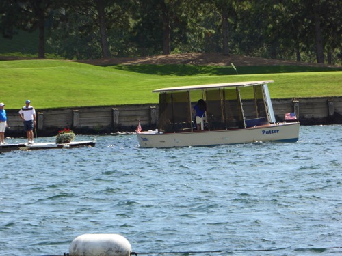
As we were walking past the CDA Resort’s wood boat, the captain was sitting there waiting for some people. So, using all my womanly charms, I teasingly asked if we could get a ride in his pretty boat. And to our surprise he said “Yes.” He said he had a group he was taking across the lake to the Resort’s golf course, the one with the floating green, and he had room if we wanted to ride out there and back. We jumped at the opportunity! It was a lovely boat with a round seating area for four people in the bow, then a round seating area with a glass cupola over it mid-ship, then the captain, then seating for 8 in the stern. Even though it was very windy and the water choppy, we enjoyed the ride and at least we got to see the floating green. Every once in a while it pays to be ‘girly’!

P1000761

P1000764

P1000767

The famous floating green.

P1000766

We had a pleasant visit with the captain as we waited for the return ride. Forty five years ago this gentleman bought a small resort with a small passenger steamship. Since the lake was used during WW2 as a naval training facility it is regulated by the US Coast Guard so he had to get his Coast Guard Captain license to transport passengers. After selling his business he started working for the resort in the summers. He holds the oldest continually used Coast Guard certification on the lake.

Following lunch we said goodbye to Jeff and Tina knowing we will see them again this winter in Quartzite or in Mexico. Safe travels friends!

Lake Coeur d'Alene Bike Trail

Thursday morning John talked me into taking another long bike ride, this time on the Coeur d’Alene Trail. To get to a good starting point we drove south to Plummer on the west side of the lake, then crossed the southern end of the lake at St. Maries, turned back north and drove up to the Harrison trailhead. Not only did this take most all the hills on the trail, it gave us a nice long 2 hour, 70 mile drive around the lake with some beautiful views of blue lakes, fields of golden wheat and green mountains.

P1000747

From Harrison we rode our bikes on a nice flat paved trail along the South Fork of the Coeur d’Alene River in an area called the Chain Lakes. We rode about 22.5 miles round trip with the river on one side and a chain of four lakes on the other. Parts of the small lakes were covered with beautiful red and white water lilies, the water was crystal clear and the surrounding mountains and hills were in sharp contrast to the flat waters. We saw some nesting osprey (or at least we think they were osprey), a great blue heron and muddy prints of a moose but did not see the moose itself. If we had continued eastward we could have ridden all the way to the bottom of the Hiawatha Trail but it would have been up hill all the way! And my bottom was telling me “No more bike rides!"

After the ride we continued on the road up the east side of the lake which followed the curves, turns, dips and climbs of the lakeshore so that a 20 mile ride took 45 minutes. But it was very pretty.

P1000750

Today we changed sites in the same campground so that we could stay through the weekend, I did the laundry and then John treated me to an extreme grilled cheese sandwich! We meet our friends at a small restaurant called ‘Meltz Extreme Grilled Cheese’ that specializes in grilled sandwiches. I had a caprese grilled cheese, John had the Oinker (why?!), Jeff had the reuben and Tina had a grilled ham and cheese. Good Stuff!

It’s not often I can talk John into going to a movie theater but Star Trek Beyond was showing so we took in the matinee along with five other people.

Wednesday, August 24, 2016

Back to Idaho

We left our Bull Lake campground reluctantly but if we want to see all of Idaho we need to move on. Our drive took us up and over the north end of Lake Pend Orville (pronounced Pon der ray) through the towns of Ponderay and Sandpoint and then south to Coeur d’Alene (pronounced Core da lane) situated on Lake Coeur d’Alene. As you may be able to tell from the names, this part of the US was settled by the French. We are staying in a commercial campground, the Blackwell Island RV Park, on the lake.

Coeur d’Alene, or as the locals call it CDA, is known for being bike friendly. There are trails all over the town, along or around the lake, up to Hayden, from the Washington line over to the Montana state line. We are only 30 miles from Spokane, WA and could ride a bike there if we were up to it (which we are not!).

Our friends, Jeff & Tina, whom we hung out with in Pocatello are in this area also so on Tuesday we met them downtown, went shopping, ate lunch at a Diner, Drive-In’s and Dives place, and shopped some more. We rode our bikes from the RV park to town and back, only 3 miles total. 

P1000745

This morning (Wednesday) we decided to tackle the Centennial Trail along the north side of the lake. The 20 mile round trip took us past the downtown area along some residential streets then along the lakeside. Except for one long hill, it was a pleasant ride. When we got back we fixed dinner for Jeff and Tina at our campsite. It was a wonderful evening with good friends.

Sunday, August 21, 2016

Kootenai Falls

Waking up with sore bodies convinced us that going for a drive today was a good thing! 

P1000732

Just a short ways north of us and not too far past where we hiked yesterday is the Ross Creek Cedar Grove. Yes, we did hike in a cedar grove but this one has level paved paths with informative signs about the trees, rocks, ferns and flowers. The Giant Red Cedars seemed much bigger as well. It was interesting to see how some grew up like twins and others were so joined together at the bottom that you did not realize it was three or four trees melded together until you looked upward.

P1000734

A little further up the road we turned to go to Libby and stopped at the Kootenai Falls and Swinging Bridge. The Kootenai River runs down from the Libby Dam on the Koocanusa Lake then turns north and runs up into Canada. The falls became a spiritual gather place for the various Kootenai Indian Tribes that were divided by this river and lake. The falls are considered to be the largest free flowing waterfall in the northwestern US. We got a fair workout walking to the viewing area for the upper part of the falls and an even better hike to the swinging bridge which spans the river. But it was worth the effort!

P1000735

P1000738

IMG 3272

P1000741

Libby is a little tourist town that is mostly closed down on Sundays but we had a nice lunch at the Cabinet Mountain Brewing Company along with a tasting of their eight different beers. RJ - you would have loved this place!

P1000743

This evening we were fascinated by the actions of two bald eagles high up in the trees across the river. Then some ducks began chasing or herding the fish in the river. It has been a delightful evening!

Saturday, August 20, 2016

N Fk E FK Bull RV

This is one road sign that we saw today and it took us a moment to interpret what it was trying to tell us. North Fork of the East Fork of the Bull River.

Yesterday we changed campsites again. We headed east then north into Montana and followed the road along the Clark Fork River past Thompson Falls and Noxon where the North Fork of the Bull River joins the Clark Fork. We visited several National Forest campgrounds and one state park before deciding to stay at the Bull River national forest campground (with our national park senior pass it is only $5 a night). We got a prime spot overlooking the river with the Cabinet Mountains in the background. For those who really want to know we are in the Kootenai National Forest in the Cabinet Mountain Wilderness Area, Montana.

John took me out to dinner at a roadhouse only a couple of miles from our campsite (the only restaurant within 10 miles) to celebrate our anniversary last night. We’ve been married 44 years! I mentioned to the young waitress that the place had a nice ambience and she said yes it had a nice atmosphere too! And I had to tell the the bartender how to make a martini! John kept reminding me that we are out in the middle of nowhere!

P1000726

After visiting with a park ranger, we opted to hike the St. Paul Lake Trail up the road from us today. The ranger said it would take us through a cedar grove up to the lake and shouldn’t be too strenuous. I guess we look or act like we are in better shape than we actually are as we never got to the lake! 

P1000727

P1000730

Before we hiked we stopped to visit the ranger stations that was built in 1909. It was on the N FK E FK Bull RV. We had a lovely hike with mountain streams near by, shaded groves of cedar, quiet paths along moss covered rocks and felled trees. Then we started climbing. You know me and going up hill, I had to slow way down. We thought the lake would be about 3-4 miles up the trail but the further we hiked, the less likelihood of finding the lake. After hiking for 2 hours we came to a stream crossing where the trail appeared to just end. As we finished our lunch another hiker came along and walked atop a log to cross the creek and let us know that the trail continued on. So we very carefully crossed the creek and hiked for another half hour. At that point we got a view of the mountains we were hiking between and the peak we were headed towards. The trail in front of us was dauntingly steep, there was no sign of a lake, we had already walked 4 miles (or at least my FitBit said we had walked that far), and our feet hurt! Time to turn around.

IMG 3258

IMG 3261

The following is part of a poem I found called 'Ross Creek Cedars' by Elfstone. 

A grandeur unexcelled demands a quiet awe.

We stop and breathe a different air;

We speak in whispered tones;

We tread softly on the living earth;

We worship by our understanding;

Her, Nature is not an abstract.

Thursday, August 18, 2016

Hiawatha - Swift as His Arrow

The Song of Hiawatha by Henry Wadsworth Longfellow tells how the Indian Hiawatha shoots his arrow with accuracy and swiftness. So the name of the rails to trails bike route was named The Trail of the Hiawatha because it runs swift and sure through the Bitterroot Mountains. We rode this trail 4 years ago and it is so unique we wanted to do it again.

Wednesday we moved from Missoula to near St. Regis to stay at the Sloway National Forest Campground on the Clark Fork River. It was still a 40 minute drive to the Hiawatha Bike Trail but we have stayed here before and it is an okay campground except for the trains that run through all day and all night. We took a warm up bike ride along the road from the campground towards St. Regis except that the road is closed now so we only rode 4 miles. St. Regis is a tiny town 5 miles up the road.

P1000723

P1000724

This morning we loaded up the bikes on the Jeep and drove to the East Portal of the Hiawatha. Most people ride down the trail then take the shuttle back up to the parking lot. We thought we were physically better so we rode down the 15 miles and back up the 15 miles! Lucky for us it is a 1.7% grade according to the signs. None-the-less our bottoms were bruised and hurting by the time we got back to the car.

IMG 3252

The railroad built this route in 1907-1910 with 10 tunnels and 6 trestles on this portion that goes through the Bitterroot Mountains. One tunnel had to be closed due to a fault line running under it. The first and longest tunnel, the Taft Tunnel, is 1.7 miles long with no lights. We were required to have head lights on the bikes or head lamps and a helmet. Once we got past the light from the entrance, it is really dark and cold and damp as there is water running down both sides of the tunnel. It is rather spooky. The other tunnels are shorter - 1700 ft., 970 ft., 760 ft. and shorter. The trestles are 230 ft. to 96 ft. tall. The scenery is beautiful. There is signage all along the route telling how the railroad track was built and the perils of the mountain, weather and other obstacles. It took 3 months to dig the 1.7 mile long tunnel working around the clock. There were 400 men inside digging, 200 outside moving the rocks and 100 men as a support crew. 

Tuesday, August 16, 2016

Missourians in Missoula

After staying in one place for 6 days, it took us a bit longer to get packed up to move on. Its only about 200 miles from Stanley to Missoula, Montana but its a scenic drive through canyons and mountains and it took most of the day to get there.

P1000719

As I said it was scenic! We followed the Salmon River almost the whole way through towering canyons, lush valleys of irrigated farm land and over the Bitterroot Mountains. We would think that the road was going to level out in a valley and then more mountains would loom or all of a sudden we were in another canyon. Our lunch stop was on the river with one of those canyon walls across the road. We also encountered some Mountain Bighorn Sheep crossing the road but it happened so quickly I didn’t get a picture.

We are staying in the Missoula KOA, the same one we stayed in 4 years ago when we visited all of Montana that summer. Our first job was to go grocery shopping. It had been over two weeks since I had been in a super market of any size. It took $250 to fill up the refrigerator! Our second and third jobs on Tuesday morning was to wash the RV and the Jeep and to do a bunch of laundry. John washed while I laundered. Our fourth job was to get haircuts. Then we went our separate ways shopping.

We sat at the Plonk Bar enjoying cocktails and small plates for dinner while visiting with a nice couple from Washington and watching the mixologist create some unique looking cocktails. It made for a very enjoyable evening.

Sunday, August 14, 2016

Busy But Not Busy

The last few days have been filled with things we are doing but nothing exciting, even though at the end of the day we are exhausted and too tired to work on the blog. The last 2 days the wind shifted and it got quite smokey from the Pioneer fire at times.

P1000714

We don’t get moving much until around 10 each morning because it is too cold! It got down to about 38° each night but once the sun gets over the mountain and shines on the RV, it warms up very nicely. John has been doing some fishing each day, sometime late morning and sometimes late afternoon. I have taken several long walks, one trail out of the campground was a pretty walk up a steep hillside through quiet forest. Another time I walked over to the service area where one could take a shower ($2 for 5 minutes) or do laundry then to the visitor’s center and then to the lodge thinking I would take in the free concert. It was so bad I left after two songs but I did get in 4.5 miles of walking. One morning we had a very good breakfast at The Bakery in Stanley and did some minor grocery shopping.

P1000717

P1000718

This morning we got in the Jeep and rode up into the hills north of Stanley lake. We were hoping for a pretty drive, maybe a little challenging for the Jeep but what we got was a gravel road through burned out forest. It was pretty in a weird way and once we got to a crest there was a nice view of the valley. I checked later and it had burned about 6 years ago. On the way home we drove by Stanley Lake.


Thursday, August 11, 2016

Mountain Hiking

Its been a few days since we got any real exercise so we geared up, packed a lunch and started to go to the Redfish Trailhead. 

But before we could leave, poor John had to fix a nasty mistake that I made in the bathroom! I added our Happy Camper black tank treatment but did not flush it down. It proceeded to form a cement like covering over the flush hole in the toilet. So after a ‘daily constitutional’ it would not flush!! We thought the toilet was permanently broken! What a mess to clean up, chop up the ‘cement’ and find that it still works. I will be indebted to John for many, many days after what he had to do! And I will ALWAYS flush the treatment down right away!

P1000707

P1000708

Now on with our hike. From the trailhead parking lot it was a short walk to the dock and we paid to take a pontoon ride to the far end of the lake where we began our adventure for the day. It was a beautiful ride on the crystal clear, blue lake with the mountains towering above. A couple of young men were on the boat with us who were going on a 6 day hike in the wilderness. Good luck to them!

P1000712

Our hike took us up the mountain side for three miles then down a short walk to the other side of the ridge and then up again for another 1/2 mile or so to the Bench Lakes region. There are actually 5 lakes in a string but we only visited two of them. From the lakes it was all downhill for another 4 1/2 miles. Luckily it was a nice day, not too hot with a slight breeze. Unfortunately, the trail was not only very dusty but full of rocks and roots. We would have to come to a complete stop in order to enjoy the views and the views were wonderful. On our right was Redfish Lake with glimpses of the White Cloud Mountain range and on the left was the Sawtooth Wilderness and mountain peaks. By the time we got back to the Jeep we were exhausted with sore feet and stiff necks (from watch our feet). It was a good night to eat out in Stanley.

Wednesday, August 10, 2016

Redfish Lake

We initially signed up for 2 nights in the Sockeye Campground but after exploring other campgrounds north of here along the Salmon River this morning we decided to stay an additional 3 nights.

P1000705

IMG 3241

Salmon River

We did a quick drive through the small town of Stanley before taking the road along the Salmon River that runs through a long canyon the width of the road and river. Walls of rock and trees towered over us on either side, sometimes giving away to flat areas filled with homes, cabins and campgrounds. Near the end of the canyon there is a place on the river with thermal waters bubbling up and people soaking in it in the river. Just down stream from that is the remains of a dam that was built in 1910 to provide hydro-electric power for a silver mine 16 miles up in the mountain. It failed in 1911. We thought about camping there too but the sites were not suitable for us. That’s when we added three nights at Redfish.

P1000701View from our campground.

We rode our bikes around the lake and over to the Redfish Lodge recreation area. They have a lovely beach and dock for boat rentals as well as kayak, paddle boards, peddle boats and floatation toys, bike rentals, guided fishing and river rafting trips. Lots of people! The lodge has rooms to rent and cabins, a general store, restaurant and lounge, snack bar and a green grass lawn for music concerts three nights a week. Another area nearby has laundry and shower services. 

We have plans for hiking, biking and fishing!

Tuesday, August 9, 2016

Off to a Rocky Start

This morning (Tuesday) we packed up and started to head up the road for 60 miles into the Sawtooth Mountains. John had read that the Redfish Lake camping area was very popular and a nice place to camp and fish on the Salmon River. Our campground host, however, suggested that we stop at another lake because it was stocked with trout and would have better fishing. Once we got to Redfish though we decided that good fishing wasn’t a reason to go back to the other lake.

But first, we stopped at the dump station, then just as John pulls out onto the gravel road, the dark sun shade for our windshield falls down! I get a frantic phone call, because I’m following in the jeep and the walkie-talkie has died, telling me what happened. He very slowly proceeds to the ranger station parking lot where we spend the next hour trying to first fix the shade then giving up on that, cutting it off. John figured out how to keep the white shade attached and working. All we can do now is to go on with our plans and figure out what to do with the shade later, and hope it does not fall down since we would not have any shade for our big windshield.

P1000700

View from our RV.

The drive up to Redfish Lake is beautiful! As we go over the pass and come down the mountain side the view of the Sawtooth mountains is spectacular! We could easily see how they got their name. Redfish Lake is a very popular area! All the signs for the campgrounds say they are full but we park the RV, retrieve our ‘Site Occupied’ sign and go looking for ourselves. Most of the first 4 campgrounds have reservable sites and they are almost all filled. The last campground is all walk-in sites and we were very lucky to snag a really nice site. The roads and RV pads are all paved, good picnic tables and grill stands, and a view of the lake with the mountains towering over it that is awesome!

Monday, August 8, 2016

Rip & Tear & Wood River Trails

After a very leisurely Sunday morning we loaded the bikes onto the Jeep and drove to the Wood River Trailhead which begins about 2 miles north of Ketchum and runs all the way to Hailey and is paved the whole way. It also circles around Ketchum on the east side. The part that goes to Hailey was once a railroad track. We did not go all the way because it was very open and windy so we circled back and took the trail that runs around the east of Ketchum thru the communities of Elkhart and Sun Valley. There was a lot of hills but we saw the Sun Valley Lodge from the back, rode past the Dollar Mountain Ski area and enjoyed looking at very expensive houses and a couple of golf courses. By the time we finished the ride we had put 18 miles on our bikes and legs!

Today we decided rather late in the morning to do the laundry and then have lunch at a popular hamburger joint called “Grumpy’s”. Can you imagine why John wanted to go there??

P1000699

We felt we needed to get some exercise so instead of finishing our bike ride up the mountain, we drove up the mountain to Galena Lodge and then tackled a 3 mile hike up Rip and Tear trail. It was made for mountain biking but we were the only people on it today. We walked past some yurts and we snuck in one to see what it looked like. It had three bunkbeds with lower beds that would sleep two and during the day would fold up to be a couch, a wood burning stove for heat, a propane stove to cook on, a sink with no faucets. and a square table in the center of the room. Signage on the outside pointed to an area of the forest for peeing and another area for gray water. It was a bit of a hike to the pit toilet. Pretty rustic! 

IMG 3239

On the way back down the trail we heard an eagle cry but we were unable to determine if it was a bald eagle, golden eagle or just a hawk. But it did make us stop and enjoy the scenery.

Saturday, August 6, 2016

Laid Back Day

With the North Fork Big Wood River right outside our door, John HAD to go fishing this morning. And its a good thing he did because the fish were biting and he caught a couple of them! I, on the other hand, went for a walk up Murdock Creek. As I was nearing the trailhead, our campground hostess drove by and gave me a ride. I ended up enjoying a nice walk with her and her two dogs. It was a lovely hike through woods and crossing the creek several times. The dogs enjoyed being loose. Misty, a golden lab, liked to fetch rocks out of the creek! Of course it was never the rock you threw in but she loved dunking her head under the water to find one. Winnie on the other hand was a runner - up the hill sides and through the bushes. It made for an interesting hike.

Later that evening John took me out to dinner at a very nice restaurant called The Ketchum Grill. We arrived early so we had time to wander around the freight wagon museum. In the mid-1800s when the silver rush was on, a company here built a business of running freight wagons up the mountain for 120 miles dropping off supplies for the miners and bringing their ores back to the smelter. The freight wagon had 3-4 narrow wagons hitched together and pulled by 14-20 mules. It would have been quite a sight!

Friday, August 5, 2016

Owe! My Poor Legs!

The Harriman Trail is 30 km (18 miles) long and ends at the pass with about 1000’ elevation change. I over estimated my ability to ride that far up hill! Part of the problem is that the trail is not paved but is a gravel path so it takes a lot more energy and strength to pedal the bike. Most people just ride on the road but I really don’t like all the cars whooshing past with just a narrow strip of pavement for me to ride on.

IMG 3233

IMG 1110

The trail took us through some lovely meadows and along the Big Wood River. We rode around some campgrounds, up some hills and through some wooded areas while enjoying the Boulder Mountain Range covered in smoke. One stop along the way was at the Easley Hot Springs where we could have swam in 86 degree thermal waters. As we approached the halfway mark my energy level was going way down. It would be close to 2 pm before we got to the top and could have lunch at the Galena Lodge so we turned around and went back down. Of course, it is much easier going down but we still didn’t get back to the RV until after 1:30. I think John could have made the trip all the way. Unfortunately, just as we turned onto our road, John developed a flat tire! I rode as fast as I could up the hill the last two miles and drove the Jeep back to pick him up. He’s a very handy man and had it fixed in no time.

Thursday, August 4, 2016

Ketchum/Sun Valley

In our haste to find a campsite, we chose one that is not very good. After some more explorations, we found another place that is much better and it even has cell service. The Murdock Campground is behind & north of the Sawtooth NRA (National Recreational Area) office, next to a nice hiking trail and 1.5 miles from the Harriman Trail. We are parked within a few feet of the North Fork of the Big Wood River. Our campground hosts are very nice and very talkative. We now know more about the arts in town than John really wanted to know. 

We drove into Ketchum and got our 10,000 steps by walking up and down the city streets, shopping the end of summer sales. John has skied Sun Valley Ski Resort twice so we drove around that part of town to see if it helped revive his memories. It didn’t! (ha!).

Wednesday, August 3, 2016

Craters of the Moon

No, we did not get on a lunar rocket! But we did drive past a huge lava field in the middle of Idaho. The Great Rift was formed 15,000 years ago when a volcano erupted and split the earth, spewing forth lava. The Rift is 52 miles long and the lava fields spread out on either side for miles. Geologist Harold Sterns discovered this area in 1923 and by 1924 President Coolidge proclaimed it as The Craters of the Moon National Monument and called it “a weird and scenic landscape."

P1000690

P1000694

Our drive through showed us only a very small part of the lava field. I met a couple whose father had flown over this area many times and was only now getting to explore it on foot. He claims it seemed to go on forever. The signs pointed out spatter cones, cinder cones that we could climb over, craters and much more. There are even lava tubes open for exploration with a permit. We did not try that.  

P1000698

P1000697

The closer we got to Ketchum and Sun Valley, the smokier the mountains became. There is a 50,000 acre wildfire to the southwest past the next range of mountains and the smoke is blowing north and east over the valley we are headed into. We are in no danger of getting caught up in the fire. In order to find a campsite we like in the Sawtooth National Forest, we parked the RV at a grocery store and drove the Jeep through three campgrounds. Due to the crowded conditions we chose the first open site we could find and placed an occupied sign on it, turned around and retrieved the RV. We are north of Ketchum about 8 miles at the North Fork Campground.

Tuesday, August 2, 2016

The Museum of Clean

We left the mountains and drove to Pocatello so that we could spend a few days with our friends Jeff and Tina with whom we became friends on our Baja Trip in 2015. We also needed to do laundry and grocery shop. They were staying in the Portneuf Recreational Complex, formerly the county fairgrounds, so thats were we camped also. Most of this morning was spent catching up with Jeff and Tina. It was a very pleasant morning with the clouds keeping the heat down until almost noon. 

IMG 1108

IMG 3222

The one place John wanted to visit in Pocatello was The Museum of Clean. When John was working he did business with the founder, Don Aslett. We asked at the front desk if Mr. Aslett was still living and the volunteer said that he most certainly was and at age 82 he wast still doing tours through the museum. About that time he completed a tour and John introduced himself to Don. It took a bit but he did remember Zephyr and John. He then showed us around some and gave John three of the 29 books he has written about how to clean and organize. He took the time to autograph them too.

IMG 3227

IMG 3226

It is a really neat museum, geared towards kids, with a hands-on kind of atmosphere. Don want kids to know that cleaning is not just women’s work!! If you stop to think about it, there are dozens of ways to clean, not just with a broom, mop or brush and not just floors. We saw antique washing machines, floor scrubbers, vacuum cleaners, toilets, bathtubs, and a dentist’s office. Army soldiers put water in their helmets to clean their face, fish keep the oceans clean, window washers, chimney sweeps, and cleaning products. Someone had been very busy taking old cleaning item parts and making them into sculptures of dinosaurs and robots. We enjoyed this very much.